
Tahoe Rim Trail.
Circular trail around Lake Tahoe - North America’s largest alpine lake.

California & Nevada

165 miles

10 - 15 days

July to September
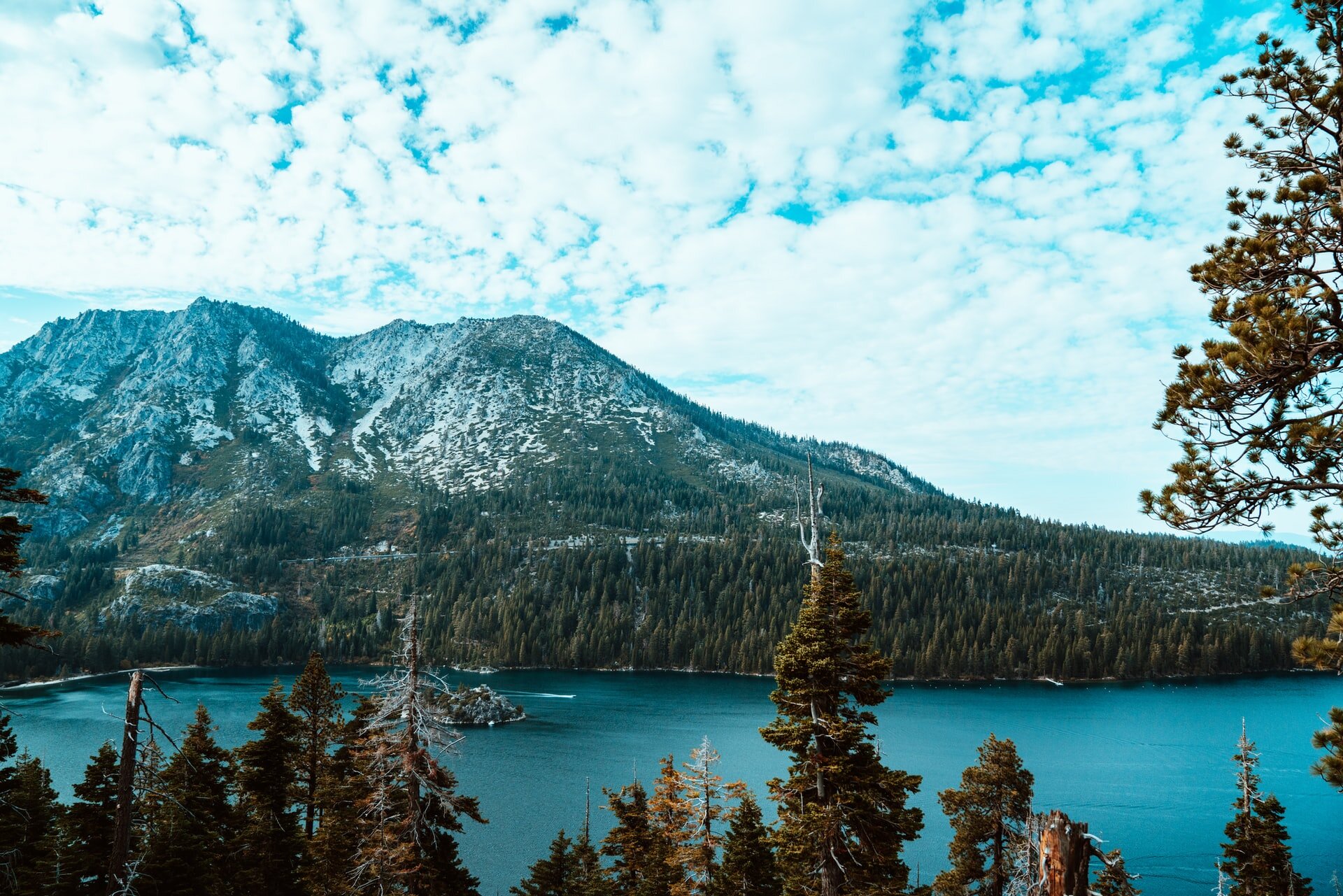
Get up close and personal with Lake Tahoe, as you traverse the Sierra Nevada and Carson mountain ranges of California and Nevada - sharing around 50 miles with the Pacific Crest Trail.
Learn about the Tahoe Rim Trail:
Why hike the TRT?
Trail map and elevation profile
Location of popular trailheads
Tahoe Rim Trail Association
Frequently asked questions
Closest international airport

Why hike the Tahoe Rim Trail?
The TRT is the perfect trail for 1st time thru-hikers.
Scenic hiking - enjoy a scenic trail, with daily mountain views without strenuous elevation gains (the TRT’s highest peak is 10,330 feet vs. the John Muir Trail @ 14,050 feet).
Trail can be completed in a 2 week holiday - experience life as a thru-hiker on this short introduction to long distance hiking, without taking months off work.
Easy to navigate - a well marked circular hike, you are never too far away from where you started!
Easily accessible - one of few circular trails, this is one of the easier hikes to organise when travelling from overseas as you finish where you start.
JMT back-up trail - you don’t need a permit to hike the TRT, making it a good option if you are unsuccessful in securing a permit for the John Muir Trail.

Trail obstacles.
You will need to be on top of weather conditions and practice bear safety.
Snowy conditions - hiking the Sierras and snow go hand-in-hand! Keep on top of weather conditions to avoid snowy conditions at higher elevations.
Bear activity - bears are active in this area and you will need to be prepared and carry a bear canister, the preferred method of food storage on the TRT.
Tahoe Rim Trail Map.

Trail map source: Tahoe Rim Trail Association
With Lake Tahoe at the heart of the trail, hike through four National Forests, three wilderness areas and two mountain ranges - of which Desolation Wilderness is heralded as the most scenic.
Elevation Profile.

Elevation profile source: Tahoe Rim Trail Association
The Tahoe Rim Trail is a great thru-hike for 1st timers, with the trail ranging in feet from 6,000′ to 10,000′ feet > peaking at Relay Peak (10,330 feet).
How to get to the trailheads.
There isn’t a north or south terminus on this looped hike - simply start and finish as you wish on one of ten official trailheads.
Two popular trailheads to start your hike:
Tahoe City:
Tahoe City is on the trail - trailhead connects with Brockway Summit.
Tahoe City is the most popular starting point.
South Lake Tahoe:
Taxi ride or bus to the trailhead - dependent on which trailhead you want to start (there are a few trailheads within the catchment area of South Lake Tahoe).
Official Trail Organisation.
Check out the official trail organisation’s website for the latest trail information, maps, events and more.

Frequently asked questions.

When is the best time to hike the Tahoe Rim Trail?
Due to snowy conditions, the trail is best hiked from July to September, before heavy snow returns in October.
July to September - 3 month hiking season
Aim for mid-July to mid-August to hike in peak wildflower season
Which direction should I hike - clockwise or anticlockwise?
The TRT can be hiked in any direction, with most hikers choosing to go clockwise.
Clockwise is the most popular direction to hike
Tahoe City is the most popular starting point
How long will it take?
Most hikers complete the TRT in 10 - 15 days, however you may be quicker or slower, dependent on many factors such as:
Fitness level and total number of miles you want to cover on a daily basis
Total number of nero days (low number of miles hiked) and zero days (0 miles hiked) you take
Side trips you may want to take
Do I need a permit?
No permits are required to hike the Tahoe Rim Trail, however you will need a day use and overnight camping permit when you reach Desolation Wilderness.
Is the trail well marked?
Tahoe Rim Trail Association advise that the trail is well marked, making it easy to stay on the trail.
As always, good preparation is key - e.g. carry paper maps, trail guide book and download the hiking app ahead of time.
How easy is it to re-supply?
There are around 15 towns surrounding the Lake Tahoe area, making it fairly easy to get off-trail and re-supply.
Starting the TRT at Tahoe City is convenient as South Lake Tahoe is located around halfway and it is a great spot to re-supply.

Connect with fellow thru-hikers online.
Join the ‘Tahoe Rim Trail Thru Hikers’ Facebook group and connect with fellow hikers who are planning to hike the same year as you!
Is public transport available?
Public transport to and from Tahoe City or South Lake Tahoe is easy, as there are many options that you can take due to the popularity of the area and proximity to Reno.
How is the water availability?
Despite looping the largest lake in North America, you will need to be on top of water sources and be prepared to take detours to the nearest water source - especially on the east shore where water can be limited.
As always, you will need to be equipped and prepared to filter and/or purify all water collected.
Is the trail busy or quiet?
You will be sharing the trail with day hikers around popular trailheads, as well as around Desolation Wilderness, but overall the trail offers an opportunity for solitude.
TRTA run a ‘165 Mile Club’ for people who have completed the trail on foot, bike snd horseback and in 2019, over 150 people joined the club!
Closest international airport.
Guide to the closest airport to the Tahoe Rim Trail.

Circular hike - start/end at Tahoe City
>> Closest airport is Reno, Nevada (RNO) <<
Book a return flight to Reno (flying via multiple US cities) or book a return flight to Los Angeles (LAX) or San Francisco (SFO) > book internal flights to/from Reno.
From Reno Airport, around 50 miles to Tahoe City (1 hr drive)
North Lake Tahoe Express operates from Reno Airport, direct to Tahoe City
