

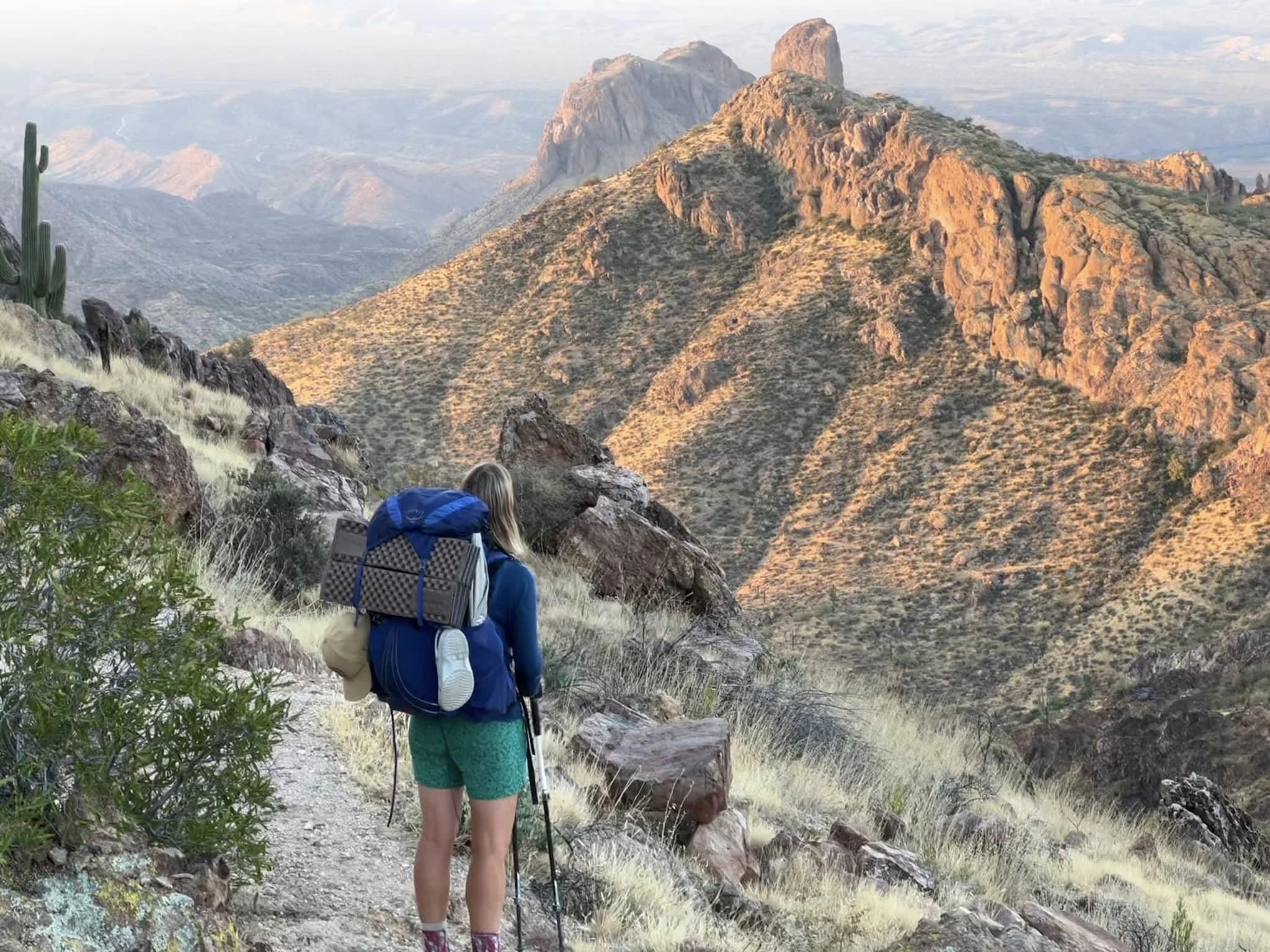
There is more to Arizona than the desert!

Arizona

800 miles

6-8 weeks

Spring & early Fall
Immerse yourself in the wilds of Arizona, spanning the entire state from the Mexican border to the Utah border. Experience diverse landscapes from deserts, mountains, canyons to pine forests - including hiking the Grand Canyon, the crown jewel of the state.
Guide to the Arizona Trail:
Why hike the Arizona Trail?
Trail map and elevation profile
Location of north and south trailheads
Arizona Trail Association
Frequently asked questions
Closest international airports

Why hike the Arizona Trail?
Hike one of the seven natural wonders of the world.
Grand Canyon National Park - hike the epic Rim-to-Rim trail, from South Kaibab Trailhead to North Kaibab Trailhead (21.8 miles, passage 38).
Side note: Backcountry permits are required to camp at the bottom of the Grand Canyon and they are extremely difficult to obtain.
The good news? AZT thru-hikers can request to camp in the stock site at Bright Angel Campground and Cottonwood Campground.
Visit the Arizona Trail Association’s website for more info.
Solitude - due to the low number of people that thru-hike the trail, the AZT offers solitude for hikers who aren't keen to hike with 100's of people.
Two hiking seasons - due to extreme weather conditions, you can hike the AZT from March to April and October to November.
Both hiking seasons are outside of peak summer months, which is great for overseas travellers as it is cheaper to fly (vs. summer).
Fun fact - the Arizona Trail Association send all successful thru-hikers a copper belt buckle for completing the trail (you just need to complete the ‘completion survey’)!

Trail obstacles.
Without access to a car, it is tricky to get to the trailhead and you will need to be on top of water sources.
Consistent elevation - check out the elevation profile, it’s safe to say that you won’t find the words ‘easy’ and ‘Arizona Trail’ in the same sentence!
Logistics of getting to trailheads - the North Terminus and South Terminus are located away from areas serviced by public transport, requiring expensive shuttles.
Water sources - you will need to research water availability along the trail and stay up to date with recent water status by visiting the ATA’s website.
Solitude - whilst great for some, solitude isn’t for everyone and it may be too quiet for social hikers who enjoy meeting lots of people on the trail.
Arizona Trail Map.

Trail map source: Arizona Trail Association
Divided into 43 passages, the Arizona Trail can be enjoyed by hikers, mountain bikers and horse riders.
>> Explore the different trail sections - Southern (passages 01 - 13), Central (passages 14 - 26) and Northern (passages 27 - 43).
Elevation Profile.

It definitely isn’t flat! The AZT has consistent elevation changes throughout the hike, with the highest elevation at Kaibab Plateau - 9,148 feet (North Rim, Grand Canyon).
Elevation profile source: Schillingsworth Shop
North and South Terminus
Travelling to and from the trailheads requires planning and money, due to limited public transport options.
North Terminus:
Utah/Arizona border, Kaibab Plateau region
From Las Vegas:
Around 250 miles to the North Terminus (4 hr 30 min drive)
Public transportation available from Las Vegas Airport to St. George, Utah (Salt Lake Express)
From St. George, it is around 130 miles to the North Terminus - no public transport available (e.g. you may need to book a private shuttle).
From Flagstaff:
Around 180 miles to the North Terminus (3 hr 30 min drive)
If you don't have access to a car, you will need to organise a shuttle or taxi as there isn't any public transport available from Flagstaff to the area around the North Terminus.
South Terminus:
US/Mexico border, Coronado National Memorial (Border Monument 102)
From Tucson:
Around 90 miles to Coronado National Memorial (1 hr 30 min drive)
There is no public transportation available to Coronado National Memorial, you will need to take a shuttle
Get the shuttle to drop you off at the Visitors Center or Montezuma Pass in Coronado National Memorial and walk to the starting point (you cannot drive to the South Terminus)
Montezuma Pass is closest @ 1.8 miles
Visitors Center @ 3 miles
National Park Service directions to Coronado National Memorial
Official Trail Organisation.
Check out the official trail organisation’s website for the latest trail information, maps, events and more.

Arizona Trail Association
The Arizona Trail Association is a non-profit organisation responsible for protecting and maintaining the trail so that it can be enjoyed by hikers, mountain bikers and horseback riders.
Follow.
Be a part of the community and join the ‘Arizona Trail Class of’ Facebook group and connect with fellow hikers who are planning to hike the same year as you.
Sign up as a member.
Support the ATA and sign up with the various membership options available and receive a range of benefits, including access to member-only trail data.
Frequently asked questions.

When is the best time to hike the Arizona Trail?
Due to extreme desert heat, there are two hiking seasons:
Spring: March - April
March is most popular month to start
Fall: October - November
October is the most popular month to start
Hike northbound or southbound?
Choosing to hike NOBO or SOBO will largely depend on the time of the year you intend to hike:
Spring - Northbound is preferred direction
Mexico to Utah
Fall - Southbound is preferred direction
Utah to Mexico
How long will it take?
Most hikers take around 6 - 8 weeks, however you may be quicker or slower, dependent on many factors such as:
Fitness level and total number of miles you want to cover on a daily basis.
Total number of nero days (low number of miles hiked) and zero days (0 miles hiked).
Side trips (off-trail).
Do I need a permit?
Whilst you don’t need a permit to thru-hike or ride along the AZT, you will need to get permits to camp at selected areas:
Colossal Cave Mountain Park (passage 8)
Saguaro National Park (passage 9)
Grand Canyon National Park (passage 38)
Arizona State Trust Lands
Is the trail well marked?
The trail is reported as being well marked, however it can be challenging at times and you will need to be prepared to use your guidebook, paper maps, data books and app.

How easy is it to re-supply?
The Arizona Trail is in close proximity to over 30 local towns and communities, making it easy to re-supply food. The towns are well spaced out, so you don't have to carry too many days of food at one time.
A few towns are located on the trail or 1 mile off the trail - Patagonia, Summerhaven and Flagstaff.
There are more towns located in the Southern sections of the trail (sections 1-13) and the least number of towns in the Northern sections (27-43) - e.g. you will need to carry more days of food in the northern section.
Connect with other AZT thru-hikers.
Connect with fellow hikers and join the ‘Arizona Trail Class of’ Facebook group - a great place to ask questions and find out more about the trail.
Is public transport available?
Shuttles are the best way to get the remote trailheads - check out ATA’s website for more information.
In addition, you can visit the 'Arizona Trail Forum', hosted by HikeArizona.com, where you can post your own questions or scan previous questions/answers under 'AZT Carpooling, Shuttles & Rides'.
How is the water availability?
Finding water sources along the trail can be a challenge, as water sources do not occur naturally along much of the trail.
To access up to date information about the current condition of available water sources on the trail, visit ATA's website and download the 'water sources file'.
In addition, find updated water information on Guthook's app.
Is the trail busy or quiet?
The Arizona Trail isn't well traveled, as until a couple of years ago, only 100 or so people complete the trail annually.
ATA keep a log of trail finishers and in 2019, only 215 people were logged as completing the trail (this includes everyone that completed the AZT and filled out the ATA's Completion Survey). You will be sharing the trail with day hikers and a lot more people around the Grand Canyon, but overall the trail offers an opportunity for solitude.
Closest airports to North & South Terminus.
Guide to the closest airports you can fly in/out of when planning your overseas trip.
North Terminus

Utah/Arizona border
Nearest Airport - Flagstaff Airport (FLG) via multiple airports including:
Phoenix Sky Harbor (PHX)
Dallas Forth Worth (DFW)
Denver (DEN)
Alternatively, fly to/from Las Vegas International Airport (LAS) or fly to LAS via Los Angeles Airport (LAX)
South Terminus

US/Mexico border
Nearest Airport - Tucson International Airport (TUS)
Fly to/from TUS via multiple airports including:
Los Angeles (LAX)
Phoenix Sky Harbor (PHX)
